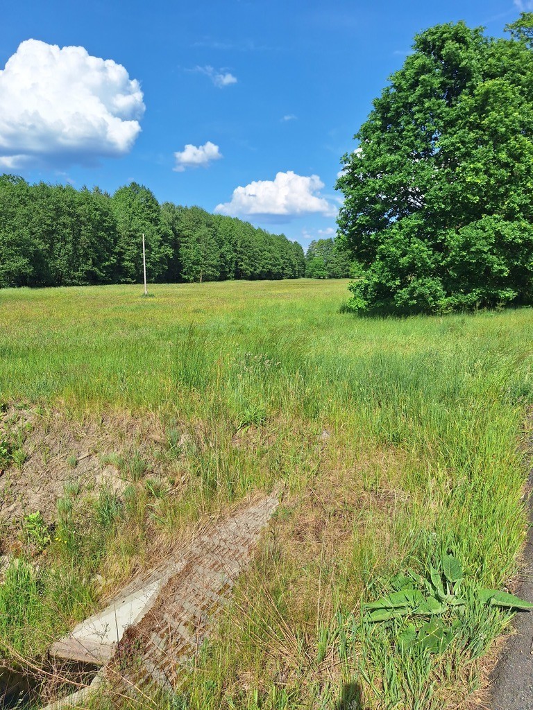

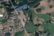
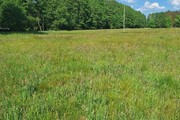


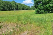

Undeveloped land property located in Tanowo, commune. Police, Police County, Voivodeship West Pomeranian Voivodeship, ul. Szczecińska, with an area of 0.3144 ha.
Type of use: Ł IV 0.3144 ha.
The above-mentioned plot was created as a result of dividing a plot with a total area of 1.7400 ha into plots with an area of 0.3223 ha, 0.3166 ha, 0.3143 ha, 0.3144 ha, 0.3362 ha and 0.1352 ha – internal road. Type of use: Ł IV (applies to all the above-mentioned plots).
The plot of the complex, with an area of 0.3144 ha and the plots of 0.3143 ha and 0.3362 ha, are covered by the spatial development plan of the commune. Police, uh. No. XX/144/2012 of May 22, 2012, oz. symbol – 6th Polish Republic, agricultural land.
The offer price for the plot is PLN 150 per m2, gross.
Transport services from the provincial road adjacent to the provincial road via internal road 01 KDW.
From the north, the plot complex borders the Gunica River.
Access to the plot is from an asphalt road (ul. Szczecińska), and then via a newly separated internal road plot (ground).
On the main road there is an electricity network, gas network and water supply network.
An opinion was prepared on the geological conditions of foundation on the plot at ul. Szczecińska.
Land and Mortgage Register – no encumbrances.
In addition, adjacent plots with an area of 0.3233 ha and 0.3166 ha are available for purchase, which are
is covered by the local spatial development plan of the commune. Police, i.e.: Uch. No. XXXV/370/2021 of the City Council of October 26, 2021 (Official Journal of the West Pomeranian Voivodeship of January 14, 2022, item 249), entitled ” Gmina Zachód”.
According to the above-mentioned plan, the plot (and the adjacent plot with an area of 0.3166 ha) is located within the area of the oz. symbol – 1 UM.
Area with symbol 1 UM with an area of 0.58 ha, intended use – service development area with residential function permitted only as a supplementary function.
– free-standing development,
– development area up to 30% of the building plot area,
– development intensity: – max. – 0.9, min – 0.05.
– building height for service buildings – up to 9 m, – for farm buildings, detached garages – up to 5.5 m.
– steep gable roofs with an angle of inclination of 30-35.
– minimum area building plot -1000 m2, plot width min. 30 m.
There is an archaeological site in the area of UM 1 and UM 2.
– biologically active surface -50%,
-the area is located within the protection zone – indirect protection area of the “Tanowo” underground water intake.
Transport services from the provincial road adjacent to the provincial road via internal road 01 KDW.
We invite you to familiarize yourself with these land properties directly in the field.
Suggested location for investors, e.g. for building a house – a center for seniors or other purposes.